Before we begin, a big thank you for your patience while we resolved our issue last week. The blog has been fully restored and hopefully there will be no further technical glitches- we are back in business!
We recently digitised NRS 20024 Photos of metropolitan, country roads ferries etc., and miscellaneous operations, NSW 1926-1946.
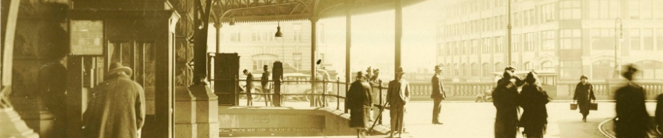
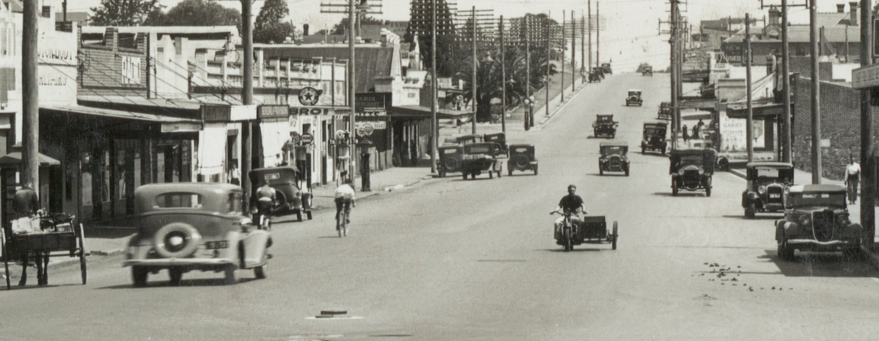
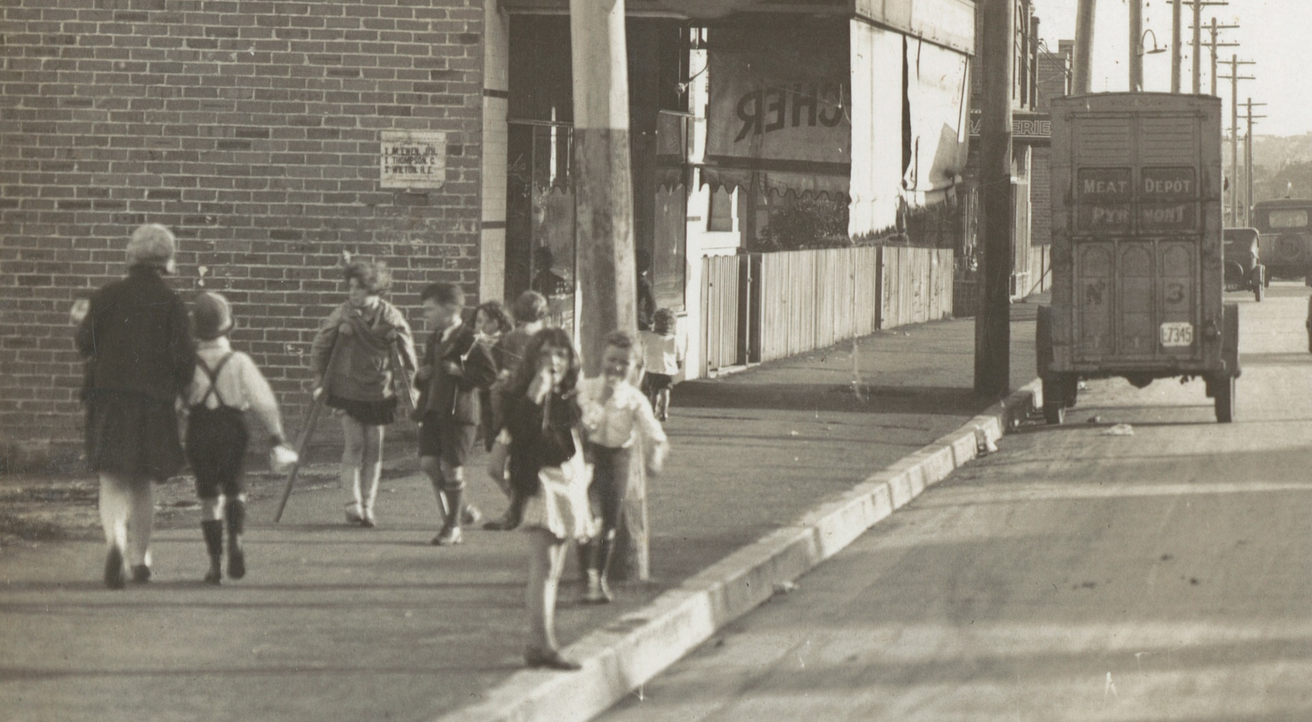
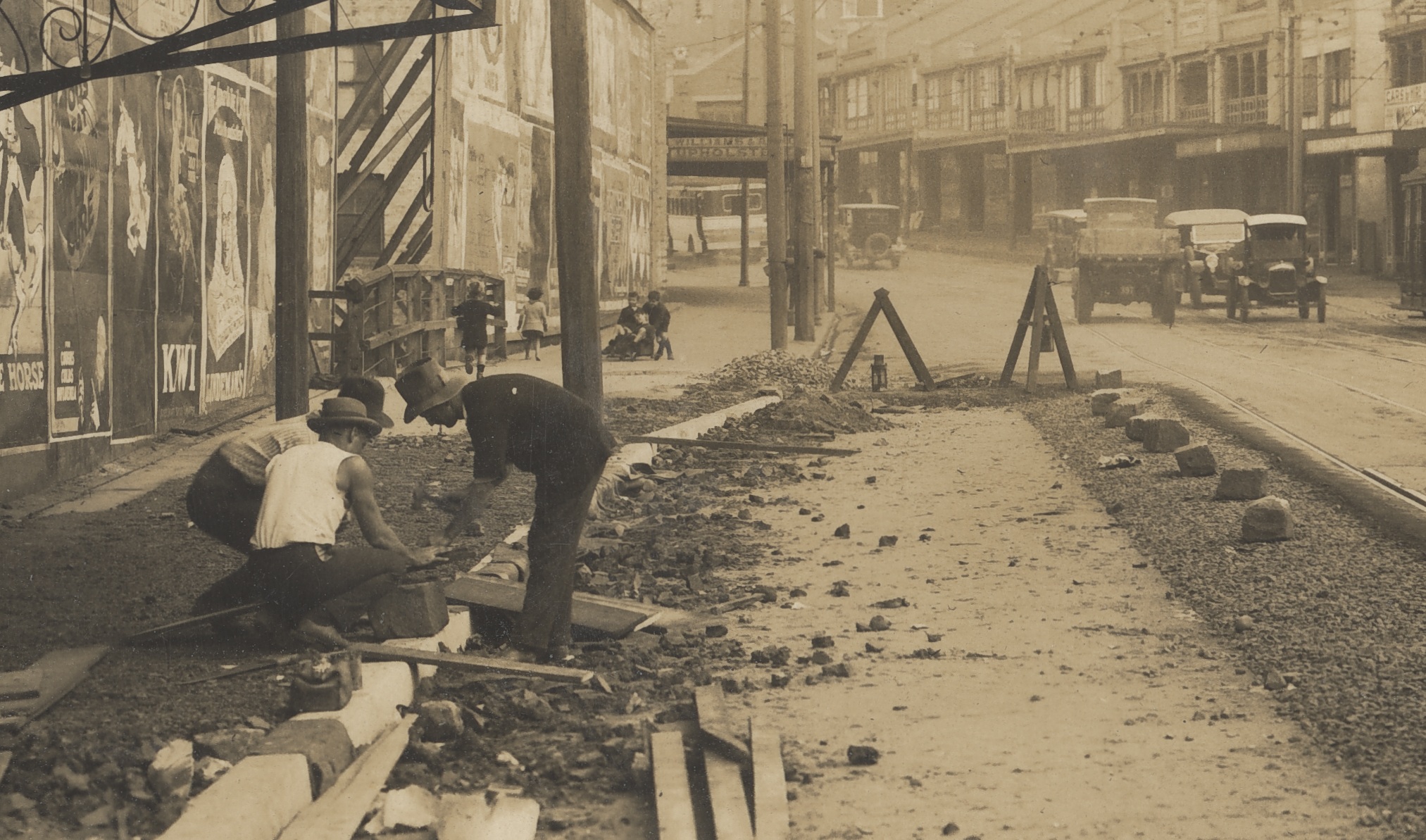
These images were taken by the Department of Main Roads to show roads before and after roadwork had been done.
While at first glance these images may seem mundane, the interest in the images lies in the detail. Zoom in and the bustle of daily life is revealed. It’s like google street view c. 1930!
Here are details taken from a few images in NRS 20224. Click on the images for a larger version or click the link below each image to see the original photograph in our catalogue.

242 Corner Botany and Henderson Roads. (Undated)
Digital ID: 20224_a038_000148
Great Western Highway – Parramatta. After reconstruction of widened section. (08/12/1936)
Digital ID: 20224_a038_000843
Cooks River Road, St Peters – Finished work. (12/09/1929)
Digital ID: 20224_a038_001073
New South Head Road Paddington – showing completed concrete with sand covering – Tar Macadam strip between Concrete and Tramway. Taken from Nield St. looking West. (Undated)
Digital ID: 20224_a038_000011
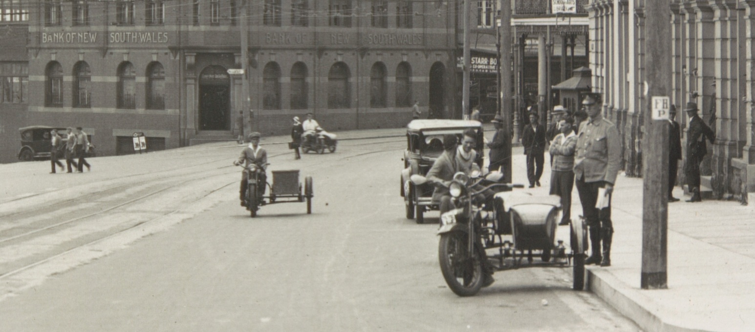
Pacific Highway S.H.10 [State Highway] Lane Cove Rd, North Sydney, near Mount Street. (04/05/1931)
Digital ID: 20224_a038_001290
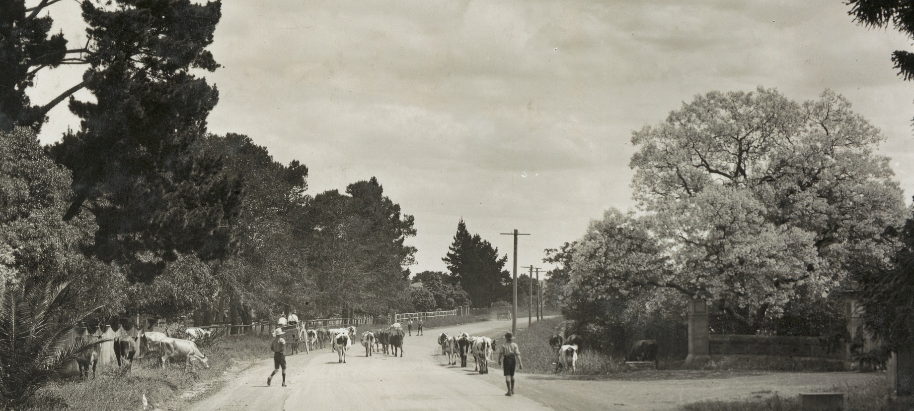
Pennant Hills Rd, Baulkham Hills. Prior to reconstruction. (19/11/1934)
Digital ID: 20224_a038_000714
JennysOldCars says:
What a great bunch of photos, lots of period details to pick out in each one.
Can I just query Pennant Hills Rd, Baulkham Hills. Prior to reconstruction. (19/11/1934)Digital ID: 20224_a038_000714
There is no Pennant Hills Road at Baulkham Hills, nor according to my 1934 Gregory’s reprint none then either. There was and is a Pennant Street at Castle Hill but it’s a stretch to vision this photo as being there because of the topography. Could it be a typo and it’s more likely to be Seven Hills Road, Baulkham Hills?
A real treat seeing the image of the Great Western Highway looking south at the intersection with Church Street Parramatta. The pub is still there but that wonderful Clifts motor garage which stood for so many years has gone, the site cleared and now just a common car sales yard.
Anna Gray says:
Hi JennyOldCars – If you have a look at the original image the full caption (which is contemprary with the image) reads “F139 – Pennant Hills Rd. S.H. 13 [State Highway]. Baulkham Hills. Prior to reconstruction”.
http://investigator.records.nsw.gov.au/asp/photosearch/search.asp?digitalid=20224_a038_000714&B1=Search
However, that’s not say whoever was writing the captions at the time didn’t get it wrong! It does raise some questions if your 1934 Gregory’s doesn’t list a Pennant Hills Road in Baulkam Hills.
JennysOldCars says:
I had noted the original caption and that it is there that the error lies, sorry wasn’t suggesting that you guys had got it wrong.
Should have looked before I submitted the comment then at what road State Highway 13 is.
In August 1928 the Main Roads Board declared the first thirteen State Highways… the full list of main roads gazetted appears in the NSW Government Gazette of 17 August 1928…. RTA Internal Classification: State Highway No. 13 HW13 Cumberland Highway Liverpool to Wahroonga…..
“State Highway No. 13 (named Cumberland Highway in August 1988) was declared one of the original thirteen State Highways selected by the Main Roads Board for proclamation on 8 August 1928. The declared route was from the junction of Pacific Hwy (then Great Northern Hwy) and Pennant Hills Rd at Pearces Corner (Wahroonga) via Pennant Hills Rd, Church St and Woodville (then Dog Trap) Road to the junction of Hume Highway and Woodville Rd at Lansdowne. This unnamed highway would provide the main route for through traffic between the Pacific and Hume Highways.” http://www.ozroads.com.au/NSW/RouteNumbering/Metroads/7/history.htm
So I’m now thinking that it’s not an error in confusing Seven Hills Road with Pennant Hills Road, it is actually Pennant Hills Road alright, but the error they made all those years ago is with the suburb – not Baulkham Hills but could be Pennant Hills or West Pennant Hills or Mobbs Hill if the Hill bit is correct. The photo shows some substantial stonework for a gateway on the right – there were a significant number of properties along Pennant Hills Road especially in the Carlingford/Mobbs Hill and Pennant Hills sections with fine large houses early last century.
Janette Pelosi says:
@Jenny Oldcars: I just checked my 1960 (20th edition) Robinson’s Street Directory. Pennant Hills Road forms a great part of the eastern boundary of the local government area of Baulkham Hills. So it is the shire not the suburb which is named in the original caption. This is typical of the State Highways files (NRS 9770) which name the municipality or shire through which the road passes. It is certainly quite a rural scene in 1934!
Chris says:
This photo was taken on what is now Pennant Hills Rd, just outside the gates of Gowan Brae (King’s School) facing south near Gollan Ave
JennysOldCars says:
Knowing now from Janette’s comment that the DMR used shire names rather than suburb names, then as the Baulkham Hills Shire (now Hills Shire) the 1934 photo could be somewhere from Thompsons Corner to North Parramatta, past the Burnside Homes. But Chris’ suggestion has narrowed it right down – the stonework in the photo certainly looks like that of the gates at the lower Gowan Brae entrance, I passed them probably thousands of times in my earlier years and should have considered that. I think you can just make out the sandstone base and wrought iron spear work fencing that still (2013) runs up the hill alongside the road too. The alignment of the Pennant Hills Road has changed only slightly since 1934 as it curves southwest past Burnside School and Homes, quite a good match if you do a Google street view too. I recall when the road was widened to 4 lanes and we all watched with trepidation each day to see that the wonderful old stone gates and fence was left intact.