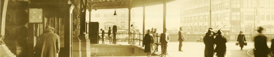
This post is brought to you courtesy of Dr Iain Stuart, a regular contributor here at Archives Outside. Iain sent us a link to a series of introductory videos about geospatial data, suggesting that it would make a great blog post. Thanks Iain!
These YouTube videos have been developed by Penn State Public Broadcasting as part of,
an integrated public media and outreach initiative about the world of digital mapping and how it is changing the way we think, behave, and interact.
This first video is a brief introductory overview. If you’re interested in exploring the topic further I’ve also posted links to the first four episodes.
Episode 1 – The first episode covers what is involved in the geospatial revolution, the origins of mapping and geospatial technology, and a look at the use of crisis mapping in Haitian earthquake relief efforts.
Episode 2 -This episode looks at how local governments and business use geospatial technology to deliver services and run efficiently, keeping a continuing eye on future developments and applications.
Episode 3 – The third episode explores geospatial technology in the world of security: how new technologies help to broker peace, wage war, and fight crime but can also compromise personal privacy.
Episode 4 – The fourth and final episode explores geospatial technology around the world: monitoring global climate change, preventing famine, tracking disease and mapping communities never before seen on a map.
Where do I find Geospatial data in NSW?
The Land and Property Management Authority site SIX (Spatial Information Exchange) contains geospatial data for NSW. It is:
The official source of NSW’s geospatial information, possessing the most comprehensive, accurate and reliable spatial data for the State and we currently service the needs of many sectors within the spatial data community.
The good news is that much of this information can be viewed for free and is well worth a look.
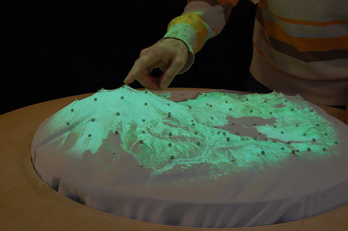
How can Geospatial data be used for Archives?
Mapping Our Anzacs from the National Archives of Australia is a fantastic example of the benefits of combining geospatial data with archives.
The heart of Mapping our Anzacs is a tool to browse 375,971 records of service in the Australian Army during World War I according to the person’s place of birth or enlistment.
This tool gives you a new way of seeing Australia’s involvement in World War I.
There are over 375,000 World War I service records in the National Archives, from a time when the population of Australia was around 5 million. These records tell the stories not only of soldiers, but also of nurses, chaplains and others.
As you browse the maps, you can see how many people came from each part of the world – including over 65,000 born overseas. Some things are visible at a glance, such as the concentration of the Australian population along the east coast. Others encourage further exploration and discovery. Why did hundreds of soldiers enlist in Egypt? How did people born in Germany come to serve in the Australian armed forces?
How would you use Geospatial data ?
chitalika andrew says:
hello there, how u doing. im a student who studies diploma in records management and i would like to be professinal how can you help me. to get material of studies